Flood Control Practices in the Big Sioux River Watershed
The Big Sioux River flows through the heart of many communities in Eastern South Dakota. While settlement along a river provides innumerable benefits, it also has its pitfalls, namely destruction following flooding events. Many cities, including the City of Sioux Falls, have installed flood control systems to mitigate these issues. Driving north of the Sioux Falls Regional Airport, you can see the diversion channel, a flood control project started in April 1956 and completed in January 1961. Designed to bypass excess flood flows from the Big Sioux River and Silver Creek, the channel flows around the city to the north and east. The undiverted water continues through Sioux Falls, combining with Skunk Creek and Willow Creek water near Louise Avenue and 26th Street. The river flows on, roaring over the Falls and reconnecting with the diversion channel just north of Smithfield Foods.
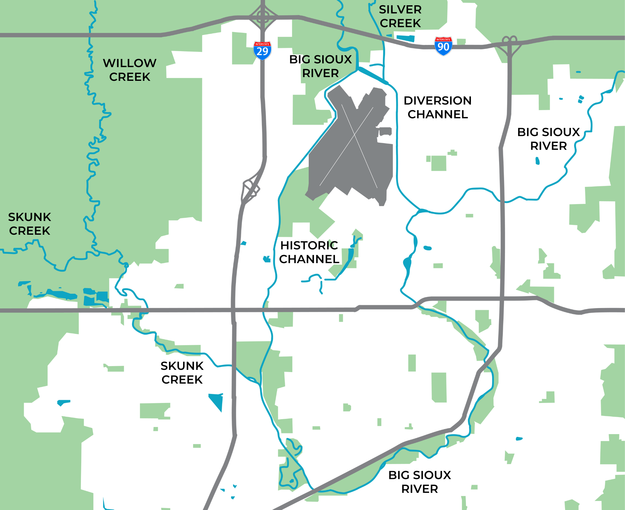
According to Andy Berg, City Engineer for the City of Sioux Falls, the amount of water flowing through Sioux Falls proper from the Big Sioux River and Skunk Creek depends on several factors, including rainfall amounts in each watershed, drought conditions, and maintenance activities. In summer, approximately 90% of the water entering the city proper comes from the Big Sioux River and 10% from Skunk Creek. Of the 90% of Big Sioux River water, 70+% of that flow is passed through the diversion dam and into the historic channel. The other 30% is sent to the diversion channel east of the city. However, during flood events or other special circumstances, this water allotment is adjusted to decrease the likelihood of severe flooding. In the summer of 2023, the City sent most of the Big Sioux River water through the diversion channel to decrease the amount of water flowing through the 6th Street bridge construction work area.
In addition to the diversion channel, the City has a variety of other flood management controls in place. There are 26 miles of levee system located along the historic river channel, the diversion channel, and Skunk Creek, along with two dams, the diversion dam and the confluence dam. Just downstream of the confluence, there is one stormwater lift station. “We have numerous outfall structures along the system that have flap gates and/or sluice gates that keep water from backing up through the levee into the protected areas,” Berg said. Although Sioux Falls does see occasional flood events, such as in 2019, the flood management controls greatly help to diminish the likelihood of severe flood damage. As you walk, bike, or drive through cities and towns in the Big Sioux River watershed, we encourage you to keep an eye out for flood control infrastructure and consider how it impacts a community’s ability to thrive in flood-prone areas.